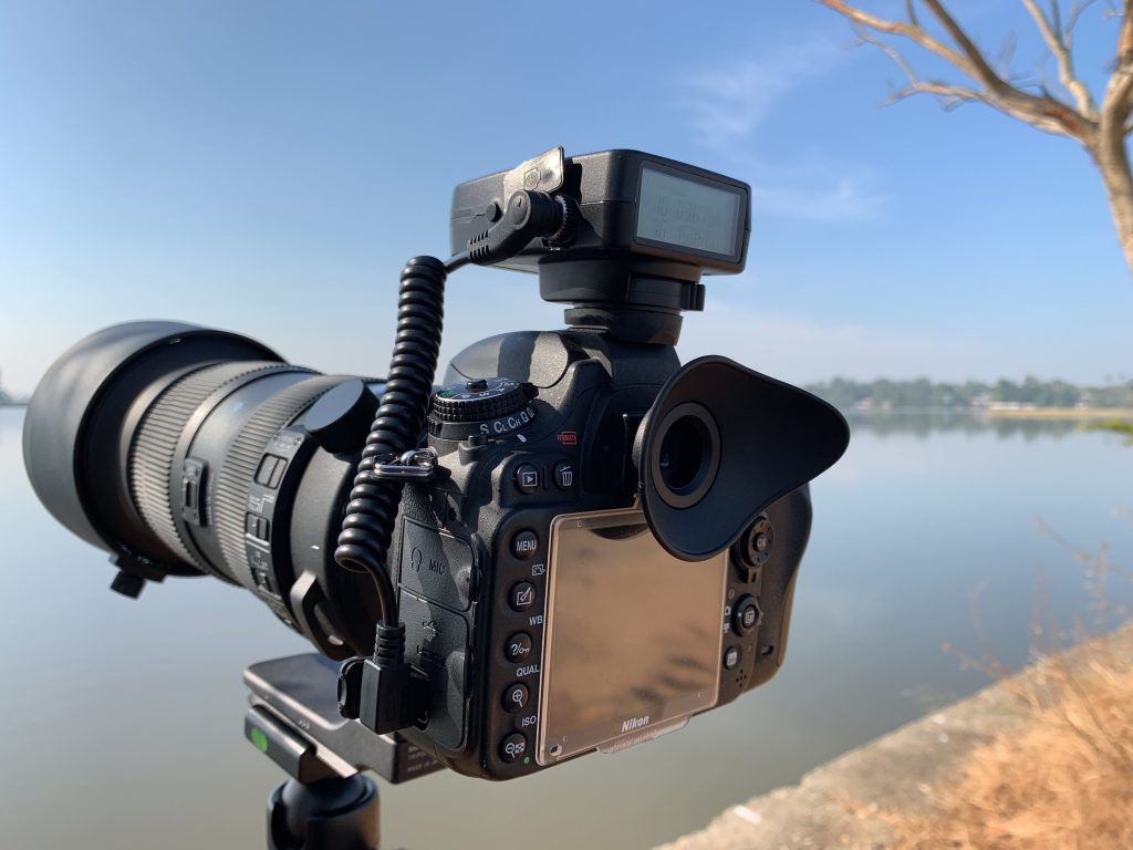
The Solmeta GMax geotagger is a versatile GPS accessory designed for Nikon and Canon DSLR cameras. It offers a range of features and highlights that make it a valuable tool for photographers who want to add precise location information to their photos. Here are some of the key highlights and features of the Solmeta GMax:
1. Real-Time Geotagging:
The Solmeta GMax provides real-time geotagging, automatically adding GPS coordinates to the metadata of your photos as you capture them. This feature ensures that each image is tagged with its precise location.
2. High Accuracy:
The device is known for its high accuracy in geotagging. It can pinpoint your location with precision, providing accurate latitude and longitude coordinates.
3. Compatibility:
The Solmeta GMax is designed to work with a wide range of Nikon and Canon DSLR cameras. It attaches to the camera’s hot shoe or accessory port, offering seamless integration.
4. Hot Shoe Mount:
The geotagger is mounted on your camera’s hot shoe, which means it doesn’t require additional cables or connections, keeping your camera setup clean and convenient.
5. Long Battery Life:
The device typically features a long-lasting rechargeable battery, allowing you to use it for extended photo shoots without worrying about power depletion.
6. GPS Track Log Recording:
In addition to real-time geotagging, the Solmeta GMax can record GPS track logs. These logs capture your entire route during a photography excursion, and you can use them for post-processing geotagging or location tracking.
7. Compass and Altimeter:
Some models of the Solmeta GMax come with a built-in digital compass and altimeter, which can be useful for certain photography applications, such as landscape and outdoor photography.
8. Built-in LCD Display:
The device may have an LCD display that provides real-time information about your location, satellite signal strength, and other relevant data.
9. Wireless Connectivity:
Some models offer wireless connectivity options for transferring geotagging data to your camera or smartphone.
10. Firmware Updates:
Solmeta often provides firmware updates, ensuring that the geotagger remains compatible with various camera models and operating systems.
11. Software Compatibility:
The geotagged information is compatible with a wide range of photography software and platforms that support GPS metadata. This makes it easy to organize, edit, and share your photos effectively.
Here’s the compatibility information for the Solmeta GMax geotagger with Canon and Nikon camera models in a table format:
| Canon Compatible Camera Models | Nikon Compatible Camera Models |
|---|---|
| Canon EOS 1D X | Nikon D4 |
| Canon EOS 1D X Mark II | Nikon D4s |
| Canon EOS 5D Mark III | Nikon D5 |
| Canon EOS 5D Mark IV | Nikon D6 |
| Canon EOS 5DS | Nikon D800 |
| Canon EOS 5DS R | Nikon D800E |
| Canon EOS 6D | Nikon D810 |
| Canon EOS 6D Mark II | Nikon D810A |
| Canon EOS 7D Mark II | Nikon D850 |
| Canon EOS R | Nikon D600 |
| Canon EOS RP | Nikon D610 |
| Nikon D750 | |
| Nikon D700 | |
| Nikon D7000 | |
| Nikon D7100 | |
| Nikon D7200 | |
| Nikon D7500 | |
| Nikon Z6 | |
| Nikon Z7 | |
| Nikon Z50 |
Get some information about the images your iPhone or iPad:
MEET THE EXIF VIEWER BY FLUNTRO APP FOR PHOTOGRAPHERS
Featured App on U.S and Canada AppStore. Understanding the details behind a photograph is crucial for refining your photography skills.
EXIF Viewer by Fluntro app can provide comprehensive metadata, including camera settings, exposure details, and geolocation data, allowing you to analyze successful shots and identify areas for improvement. By dissecting the EXIF data, iPhone photography users can gain valuable insights into their shooting techniques, enabling them to make informed adjustments and elevate their photography prowess.
- View EXIF Data: Quickly access the EXIF tags of your Photos and Videos, providing essential information about camera settings, location data, and more.
- Remove EXIF Data: Safeguard your privacy by easily removing EXIF metadata before sharing Photos and Videos on social media or other platforms.
- Edit EXIF Data: Modify incorrect details like date and time, ensuring accurate image information.
- Geolocation Details: Instantly view, remove and edit Geotagging – GPS location, GPS coordinates, altitude, and direction with advanced features.
Appstore Download Link: – https://apps.apple.com/us/app/exif-viewer-by-fluntro/id944118456
Visit the App Store on your iPhone or iPad. Search for “EXIF viewer by Fluntro“. Download and install the app.
EXIF Viewer by Fluntro App showing images Camera details .
Checkout the preview video of Exif Viewer by Fluntro:
