In today’s world of advanced photography, the ability to capture not just images but also the technical details behind those photos is essential. Whether you’re a photographer, traveler, or drone enthusiast, knowing the altitude and speed at which a photo was taken can provide invaluable insights. With modern devices and advanced metadata capabilities, checking altitude and speed is now easier than ever, and in this guide, we’ll show you how.
Why Altitude and Speed Data Matter in Photography
The inclusion of altitude and speed in your photo’s metadata can provide deeper context for your images, helping you remember where, how high, and how fast you were when capturing a shot. Whether you’re capturing aerial photos with a drone or snapping shots on a moving vehicle, this information can enhance your storytelling.
For outdoor adventurers, knowing the altitude of your photo location adds perspective to your adventure. Photographers capturing fast-moving subjects—like in sports or wildlife photography—will benefit from the speed data to understand how it affects motion blur and focus in their images.
What Is EXIF Data?
EXIF (Exchangeable Image File Format) data is a treasure trove of information embedded in every digital photograph. It stores a wide range of information, from the camera model and settings to GPS data, including altitude and speed. Accessing this metadata allows photographers to analyze and understand the conditions under which a photo was taken.
Key EXIF Data Elements Include:
- Camera Settings (aperture, shutter speed, ISO)
- Timestamp (when the image was taken)
- GPS Coordinates (location of capture)
- Altitude and Speed (if available)
- Device Information (camera model, lens, etc.)
How to Check Altitude and Speed in Photos
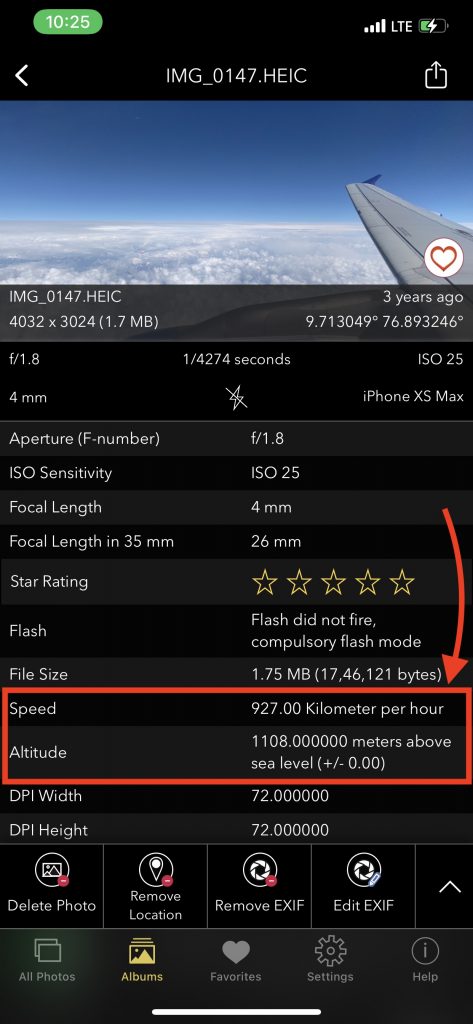
To view the altitude and speed at which a photo was taken, you’ll need a tool that can access and display EXIF metadata. Here are a few steps to easily access this information using our EXIF Viewer app:
Step 1: Install the EXIF Viewer App
First, download the EXIF Viewer app on your smartphone or desktop. This app is designed to read and display all the metadata associated with your images, including altitude and speed data.
Step 2: Upload or Open Your Photo
Once the app is installed, open it and upload the photo you want to analyze. The app will automatically extract all EXIF data from the image.
Step 3: View the Altitude and Speed Data
After the image is uploaded, navigate to the GPS section in the EXIF data. If your device captured altitude and speed, these values will be displayed in this section.
- Altitude is typically displayed in meters or feet above sea level.
- Speed is shown in kilometers per hour (km/h) or miles per hour (mph), depending on your settings.
Step 4: Analyze and Use the Data
Now that you have access to the altitude and speed data, you can use this information to better understand the context of your photos. Whether you’re documenting a hiking trip at high altitudes or reviewing drone footage, this data is invaluable.

Devices That Capture Altitude and Speed Data
Not all devices capture altitude and speed data, so it’s important to know whether your camera or smartphone supports these features. The devices that typically record this information include:
- Drones: Most modern drones, such as those from DJI, automatically record altitude and speed in their EXIF data.
- Smartphones: Many smartphones with built-in GPS capabilities, like the iPhone and Android devices, can record altitude and speed when the location services are enabled.
- GPS-Enabled Cameras: Some DSLR and mirrorless cameras come with GPS modules that can log altitude and speed data. For example, certain Nikon and Canon models offer built-in GPS functionality.
Importance of GPS Accuracy for Altitude and Speed
The accuracy of the altitude and speed data is highly dependent on the quality of the GPS signal. In urban environments or densely wooded areas, your device’s GPS may struggle to provide accurate readings. For the most accurate altitude and speed data, ensure your device has a clear line of sight to the sky, which will improve GPS signal strength.
Troubleshooting Missing or Inaccurate Altitude/Speed Data
If you’re not seeing altitude or speed data in your photos, here are some common reasons and solutions:
- Device Limitations: Not all devices support GPS or speed recording. Check your device’s specifications to ensure it can capture this data.
- GPS Signal Issues: If the GPS signal was weak or lost during capture, altitude and speed data may be missing or inaccurate. Try ensuring that GPS location services are enabled and functioning correctly on your device.
- EXIF Stripping: Some social media platforms and apps strip metadata from images to reduce file size. Be sure to check your original photo file rather than one uploaded to a social platform.
Conclusion
Checking the altitude and speed at which a photo was captured provides more than just technical information—it enhances the narrative of your images. With tools like the EXIF Viewer app, you can unlock these hidden details in your photos and gain a deeper understanding of the context in which they were taken. Whether you’re an aerial photographer, adventurer, or casual hobbyist, this data can enrich your photographic experience.
To start analyzing your photos, download the EXIF Viewer app today and explore the untold stories behind your images.
FAQs
1. Can all smartphones capture altitude and speed data?
No, only smartphones with GPS capabilities can capture this information. Ensure your phone’s location services are enabled before taking a photo.
2. How accurate is the altitude data from my device?
The accuracy depends on the strength of your GPS signal. For the best results, capture photos in areas with a clear view of the sky.
3. Can I add altitude and speed data to a photo later?
Yes, certain software tools allow you to manually add or edit EXIF data like EXIF Viewer by Fluntro, but it’s always best to capture this information at the time the photo is taken.
CHECK OUT THESE APPS FOR YOUR IPHONE AND IPAD:
1. PHOTOS SEARCH BY FLUNTRO
YOUR ULTIMATE PHOTO DISCOVERY COMPANION!
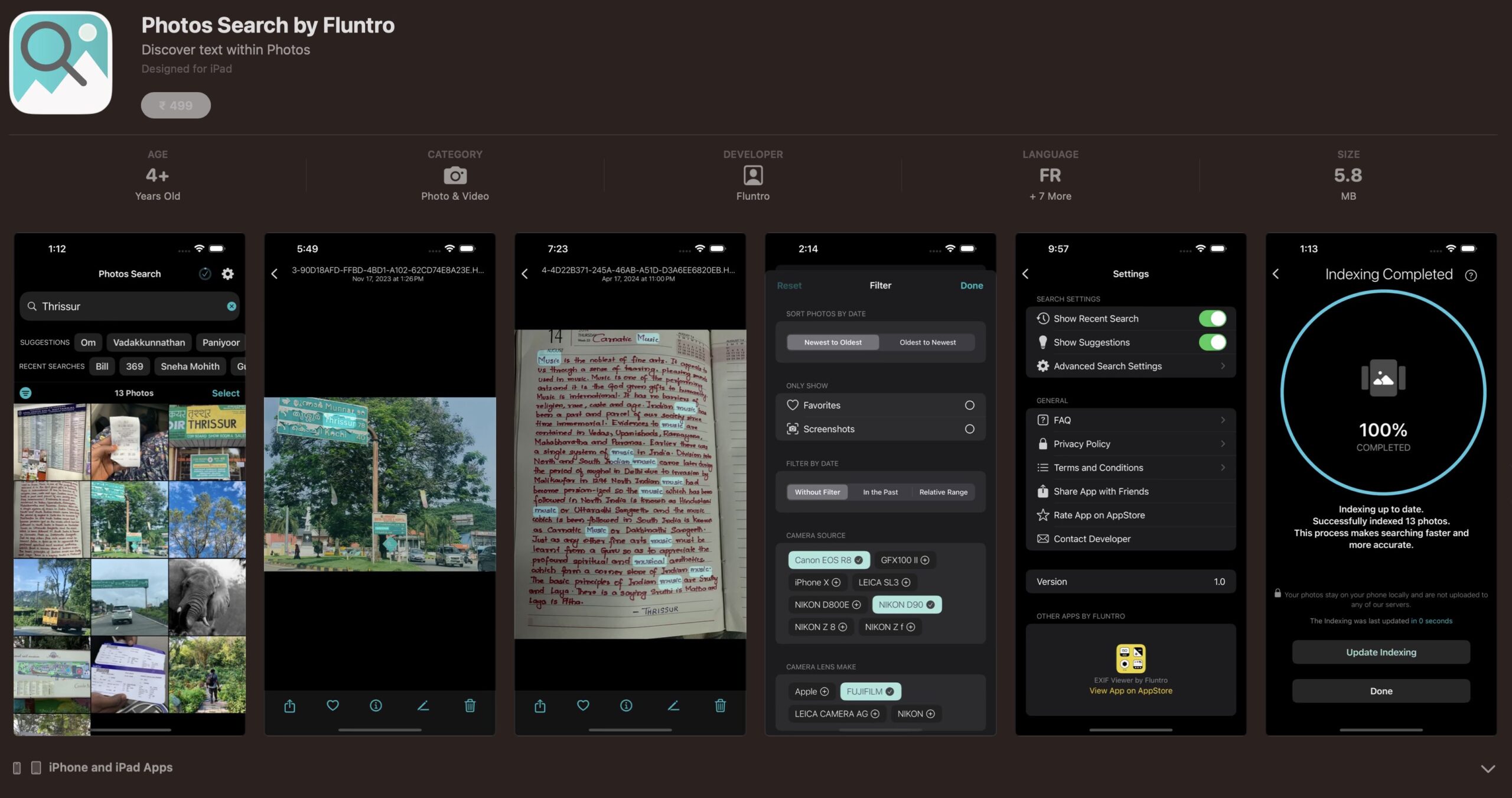
Photos Search app takes image searching to a whole new level by allowing you to search for text within photos effortlessly. Unleash the potential of your visual content and discover a seamless way to find and organize your images based on the words they contain. Whether you’re a professional photographer, an art enthusiast, or simply someone who loves exploring beautiful imagery, PhotoSearch is here to make your search for photos a delightful and hassle-free experience.
AppStore Link: https://apps.apple.com/app/photos-search-by-fluntro/id6471649312

Get two apps by Fluntro Team :Exclusive Bundle Offer

“Exif Viewer” for $2.99 and “Photos Search” for $4.99
Just for $5.99 instead of $7.98

2. KIANA
CUTE ELEPHANT STICKERS FOR IMESSAGE AND IOS
Express yourself with Kiana the Elephant’s adorable sticker collection!
With 66 charming stickers, there’s a cute expression for every mood. From daily chats to special moments, Kiana add joy and whimsy to your conversations. Share laughter, love, and fun with friends and family through these delightful illustrations. Explore a world of playful expressions, featuring Kiana in a variety of charming poses. Spice up your messages with Kiana: Adorable cute elephant stickers today!
Appstore link :- https://apps.apple.com/us/app/kiana-cute-elephant-stickers/id6504343965

Pingback: 5 Easy Ways to Add Text to Photos on iOS - EXIF Viewer by Fluntro