In the digital age, photography has evolved beyond just capturing moments; it’s become a means of storytelling and expression. With advancements in technology, photographers now have a powerful tool at their disposal: geotagging with EXIF data. This hidden gem in your digital photographs allows you to capture not just the visual beauty but also the geographical context of the moment. In this blog post, we’ll explore the world of geotagging, what EXIF data is, and how you can leverage it for location-based photography projects.
What is EXIF Data?
EXIF stands for Exchangeable Image File Format, a standard for storing metadata in image files. This metadata includes various details about the photo, such as camera settings (aperture, shutter speed, ISO), date and time of capture, and crucially, GPS coordinates. The latter is what makes geotagging possible.
GPS Coordinates in EXIF Data
When you enable the GPS feature on your camera or smartphone, it embeds precise latitude and longitude coordinates directly into the EXIF data of your photos. These coordinates are generated by the GPS receiver in your device, pinpointing the exact location where the photo was taken.
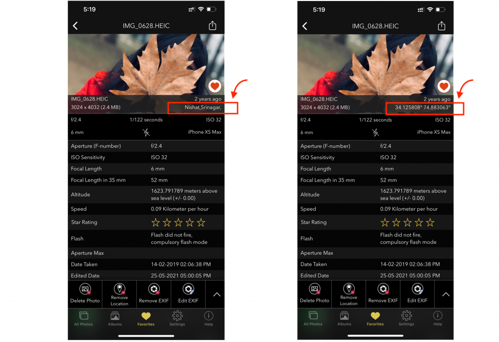
Screenshot of an image with EXIF metadata using Exif Viewer App by Fluntro on iPhone
Benefits of Geotagging with EXIF Data
- Location Preservation: Geotagging allows you to preserve the location where your photos were taken, adding an extra layer of storytelling to your images. Whether it’s a picturesque landscape, a bustling city, or a remote wilderness, knowing the location can help viewers connect with the scene on a deeper level.
- Easy Organization: Geotagged photos are much easier to organize and search through. You can sort your images by location, making it a breeze to find specific shots from a particular place.
- Location Scouting: For landscape and travel photographers, geotagged photos serve as valuable references. You can revisit the same locations at different times of the year or day, ensuring you capture the scene under various conditions.
- Collaboration: If you collaborate with other photographers or share your work online, geotagged images provide a convenient way for others to explore and appreciate the locations you’ve captured.
Location-Based Photography Projects
- Travel Journals: Create captivating travel journals by geotagging your photos from different destinations. Share your adventures with friends and family, or even turn them into a blog or a coffee table book.
- Environmental Documentation: Geotagged photos can be invaluable for documenting changes in the environment. Scientists and conservationists use such data to monitor natural habitats, track deforestation, or assess the effects of climate change.
- Event Photography: Capture the essence of local events, festivals, or parades by geotagging your photos. It helps in showcasing the uniqueness of each location’s cultural celebrations.
- Location-Specific Art Projects: Use geotagged images as inspiration for location-specific art projects. Paint, sketch, or create digital art based on the geographical context of your photographs.
How to Geotag Your Photos
- Built-In GPS: Most modern smartphones and some digital cameras come equipped with built-in GPS receivers that automatically geotag your photos.
- Geotagging Apps: If your camera doesn’t have GPS capabilities, you can use smartphone apps like GeoTag Photos Pro, GPS4cam, or even Google Maps to manually geotag your photos.
- Desktop Software: After transferring your photos to a computer, you can use desktop software like Adobe Lightroom or specialized geotagging software to add location information to your images.
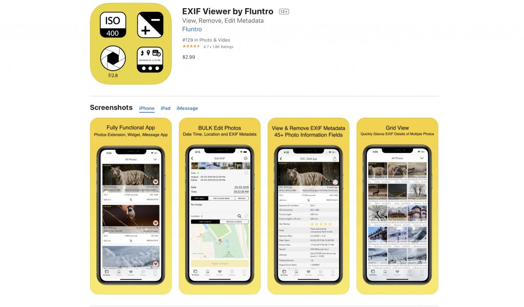
There are also mobile apps that can view, remove and Edit EXIF metadata for images saved on your device. For iOS user we suggest Exif Viewer by Fluntro.
Highly Recommend to try out Lite (Free Trial version) first
Appstore link of Free Lite version :- https://apps.apple.com/us/app/exif-viewer-lite-by-fluntro/id979066584
Appstore link of Paid Full version :- https://apps.apple.com/us/app/exif-viewer-by-fluntro/id944118456
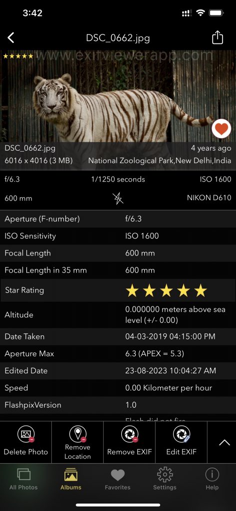
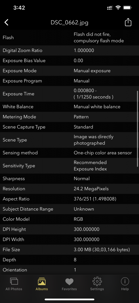
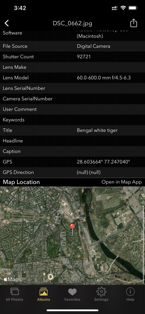
Screenshot of EXIF Viewer by Fluntro app displaying detail view of all exif information of a photo
Geotagging with EXIF data is a powerful tool that enhances the storytelling potential of your photography. It allows you to preserve, organize, and share the geographical context of your images, making them more engaging and meaningful. Whether you’re a travel enthusiast, environmental advocate, or simply a photography enthusiast, geotagging opens up a world of possibilities for your creative projects. So, the next time you venture out with your camera or smartphone, remember to enable GPS and let your images tell the story of the world, one location at a time.
Checkout the preview video of Exif Viewer by Fluntro:
RELATED TOPICS:
– WHAT IS GEOTAGGING IN PHOTOGRAPHY?
– HOW TO TURN ON OR OFF PHOTO GEOTAGGING ON YOUR IPHONE OR IPAD
– HOW TO VIEW GPS LOCATION COORDINATES OF PHOTOS ON IPHONE OR IPAD?
– EXIF DATA: WHAT IT REVEALS ABOUT YOUR PHOTOS
–HOW TO ADD GEOTAGS TO PHOTOS ?
– HOW TO FIX IPHONE PHOTOS NOT SHOWING LOCATION?
– METADATA IN PHOTO EDITING: ALTERATION IN EXIF DATA
CHECK THESE APPS FOR YOUR IPHONE AND IPAD:
1. PHOTOS SEARCH BY FLUNTRO
YOUR ULTIMATE PHOTO DISCOVERY COMPANION!
Photos Search app takes image searching to a whole new level by allowing you to search for text within photos effortlessly. Unleash the potential of your visual content and discover a seamless way to find and organize your images based on the words they contain. Whether you’re a professional photographer, an art enthusiast, or simply someone who loves exploring beautiful imagery, PhotoSearch is here to make your search for photos a delightful and hassle-free experience.

AppStore Link: https://apps.apple.com/app/photos-search-by-fluntro/id6471649312
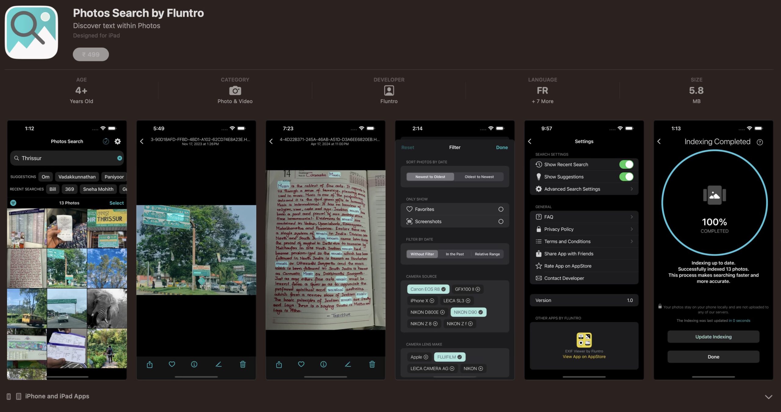
Get two apps by Fluntro Team :Exclusive Bundle Offer

“Exif Viewer” for $2.99 and “Photos Search” for $4.99
Just for $5.99 instead of $7.98

2. KIANA
CUTE ELEPHANT STICKERS FOR IMESSAGE AND IOS
Express yourself with Kiana the Elephant’s adorable sticker collection!
With 66 charming stickers, there’s a cute expression for every mood. From daily chats to special moments, Kiana add joy and whimsy to your conversations. Share laughter, love, and fun with friends and family through these delightful illustrations. Explore a world of playful expressions, featuring Kiana in a variety of charming poses. Spice up your messages with Kiana: Adorable cute elephant stickers today!

Appstore link :- https://apps.apple.com/us/app/kiana-cute-elephant-stickers/id6504343965
